
Pflugerville ZIP Code Coverage
Start ZIP coverage with a working delivery-area map, not a claim that every listed address lies inside the same city boundary. Official sources associate five ZIP codes with Pflugerville or its edges. The common delivery area is 78660. The other codes appear in rural, Hutto, Manor, or Round Rock edge contexts. A street-level USPS check remains necessary because a postal label can cross an incorporated line, an ETJ, or a county line.
| ZIP | Areas covered | Post office | Record-search note |
|---|---|---|---|
| 78660 | Central and broad Pflugerville delivery area; property and association sources include Blackhawk, Falcon Pointe, Heatherwilde, Windermere, and Spring Trails | USPS delivery ZIP; station assignment depends on the address | Primary Pflugerville delivery ZIP, not proof of incorporated status |
| 78691 | Pflugerville-area rural and edge delivery context; ZCTA intersects the city | USPS delivery area; address-dependent detail | May extend beyond the city line |
| 78634 | Hutto and Pflugerville-area rural or edge addresses | USPS delivery area | Postal city and municipal boundary can differ |
| 78653 | Manor and Pflugerville-area edge addresses | USPS delivery area | Check county GIS and CAD before choosing a custodian |
| 78664 | Round Rock and Pflugerville-area addresses; Cielo East City Homes appears in association material | USPS delivery area | Can cross municipal and county lines |
Research did not verify a local station name for each route, a PO-box-only Pflugerville ZIP, or a unique-institution ZIP. Those are gaps, not facts to infer from a map. The five codes above are a practical starting set from official and county sources. For the delivery ZIP that applies to one address, use the Postal Service result before treating a mailing city as a location clue.
Pflugerville Postal Delivery Geography
A ZIP code is a Postal Service delivery geography. It is not a city boundary, tax jurisdiction, or proof that a person receives mail at an address. Census ZCTAs are also different from live postal delivery routes. They are statistical areas built from ZIP geography and can supply broad population context, but they cannot answer whether a particular house is incorporated Pflugerville.
This distinction is especially important locally. City limits include Travis and Williamson County portions, while the city address service also covers the ETJ. A sender's printed city, a USPS recommended city, and a CAD mailing field can all be useful labels. None should displace the parcel situs, legal description, county account, or city boundary layer when a records question needs an authoritative location.
Note: Preserve the mailing city, delivery ZIP, and parcel situs separately when a Pflugerville address falls near an edge.
Pflugerville USPS Address Checks
The USPS ZIP Code Lookup is the authoritative route for delivery verification. It supports an address search, a city and state search, and a cities-by-ZIP search. The Postal Service also warns that a ZIP result does not confirm that a person or company is at an address. Use it to standardize a mailing address, then turn to the county, city, or clerk record that answers the person or parcel question.
The captured USPS screen shows the three modes that are actually available for ZIP-oriented checking.
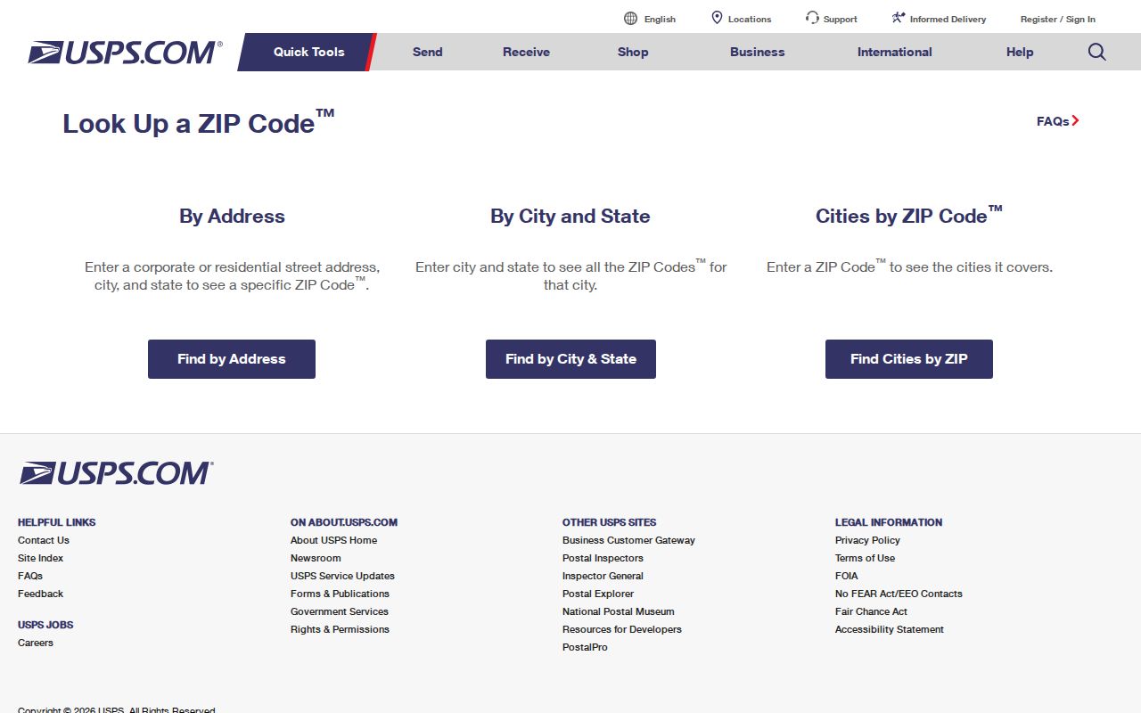
The Postal Service result is the first layer of a ZIP code directory search, not the final identity or boundary check.
| USPS mode | Fields supplied | Best use |
|---|---|---|
| Address | Company, street address, apartment or suite, city, state, ZIP | Verify one delivery address and recommended format |
| City and state | City and state | Explore delivery ZIP options for a place name |
| Cities by ZIP | ZIP | Check the cities associated with one ZIP |
Pflugerville ZIP Code Parcel Clues
Property portals use county custody, not postal convenience. Travis CAD accepts owner name, property address, account number, and DBA. WCAD accepts name, address or account, and property identifier modes. The base WCAD page did not expose a verified ZIP filter, so do not assume that an advanced filter will produce a ZIP-wide resident list. Address and account searches are the defensible way to move from a verified delivery address to the correct parcel.
The WCAD parcel-card capture illustrates the difference. Its fields can include the owner, property or situs address, mailing address, neighborhood, legal description, subdivision or phase, block, lot, acreage, account, map number, values, and exemptions. The card itself cautions that data and maps are provided as-is and does not guarantee current occupancy.
The WCAD sample property detail makes that situs and mailing split visible.
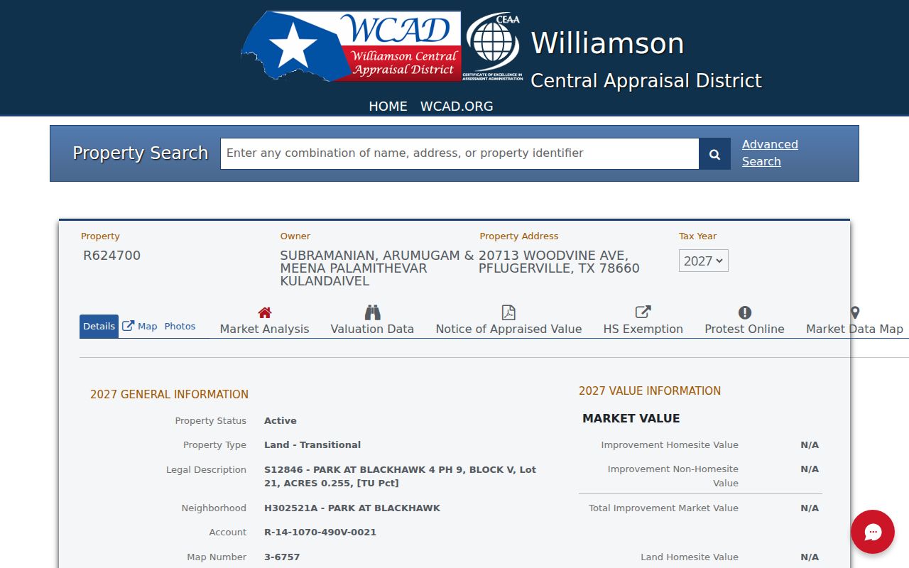
A Pflugerville mailing ZIP on a card can coexist with a Taylor or Coupland situs, so the legal parcel fields control the records path.
Pflugerville ZIP Record Steps
A ZIP narrows a delivery question, but it does not create a list of residents. City GIS does not publish a ZIP directory of people, and TEAM voter lookup uses county and identification or name modes rather than ZIP browsing. A ZIP-filtered license search can return records with a location ZIP for a selected program, not everyone associated with that delivery area. Follow an address from USPS to GIS, CAD, and the controlling county custodian.
- Verify the street address and delivery ZIP through USPS, including the recommended city and state form.
- Check city or county GIS to determine incorporated, ETJ, and county status for that address.
- Search Travis CAD or WCAD by the address, account, or property identifier and preserve the situs, mailing, and legal-description fields.
- Use the county, jurisdiction, and address-specific identifiers for clerk, court, voter, or permit questions. A lawful voter-file request is a separate county or SOS transaction.
- For a historic address, pair old road, route, or post-office terms with a deed, plat, census, tax roll, or rural directory.
Once a ZIP has narrowed the delivery area to a named street, the Pflugerville street directory provides the separate address-by-address record trail. That distinction prevents a ZIP from being used as a shortcut for county records that are keyed to a parcel, party, case, or legal description.
Pflugerville Two-County ZIP Geography
Pflugerville's incorporated footprint reaches into both Travis and Williamson Counties. The city Address service provides current city and ETJ addressing context, while the City Limits layer is current boundary evidence. Neither layer is a legal survey or a complete historic annexation-to-address bridge. Use city GIS to understand where an address sits, then use the correct CAD and county clerk for the parcel, deed, tax, probate, or court custodian.
The Pflugerville City Limits ArcGIS layer is the appropriate map layer for the incorporated-boundary question.
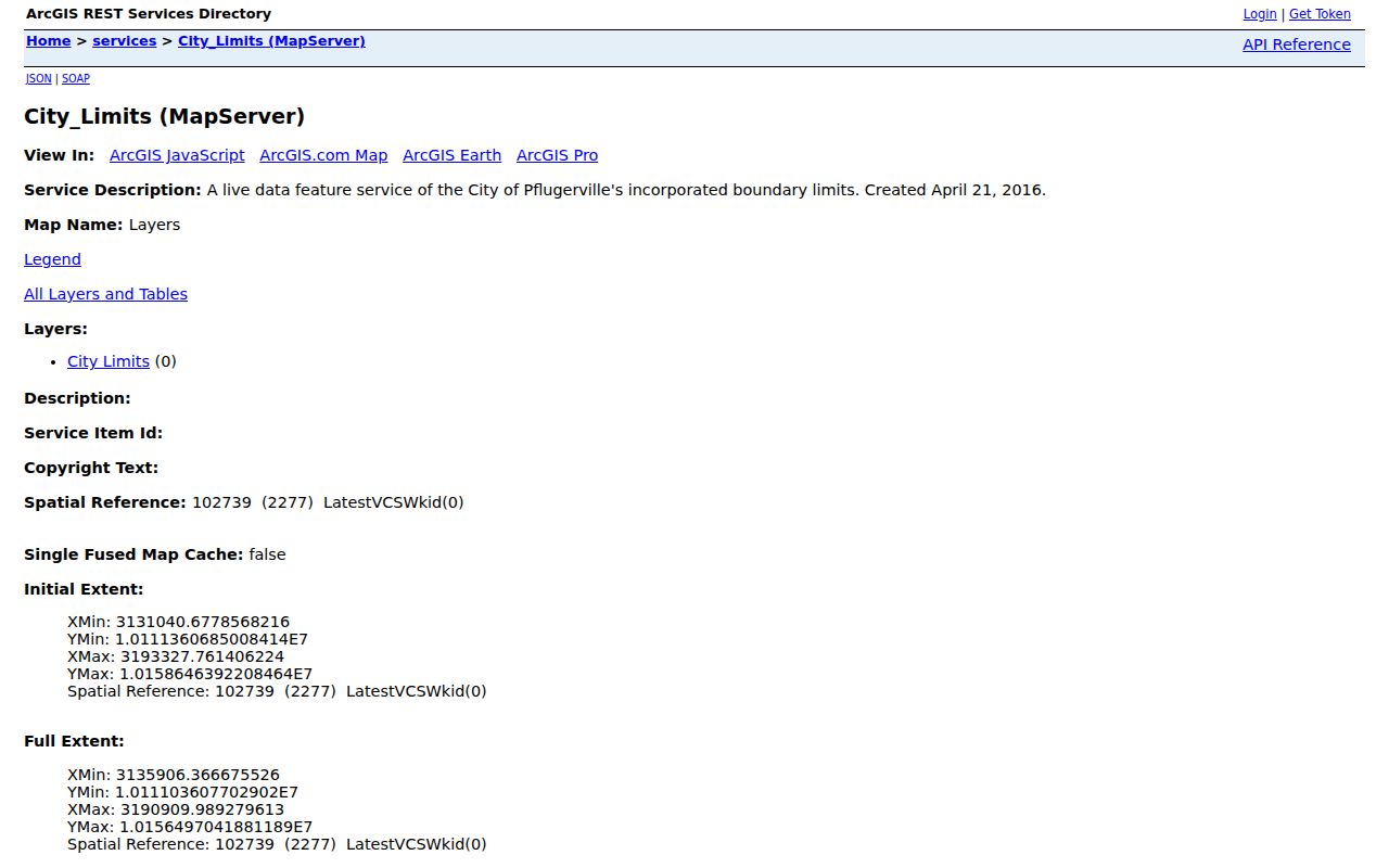
The GIS capture supports a boundary check, but county CAD and clerk records remain the sources for parcel ownership and recorded documents.
That geography is the Profile 3 issue that changes every ZIP search. A Pflugerville postal address can be outside the incorporated line, and a parcel inside the city can still be filed in a county office. Start with the exact address, not the city printed on an envelope. Then record the city, ETJ or city-limit result, county, ZIP, situs address, and legal description as separate fields.
Pflugerville ZIP Code Boundary Limits
ZIP results and municipal boundaries disagree in several locally documented ways. WCAD sample cards have shown a Pflugerville mailing address for a taxable property with Taylor or Coupland situs. An association record can carry a Pflugerville-area name and a 78664 ZIP. Census profiles identify 78660 and 78691 as ZIP or ZCTA areas intersecting the city, but an intersection is not a claim that all addresses within that area are incorporated. For a boundary question, use USPS for mail, Census for statistics, GIS and CAD for location, and the clerk for the legal record.
Do not rely on a ZIP-wide roster. The city GIS and TEAM lookup do not expose one. A county or state voter-list request has separate lawful-use, field, and redaction rules, and it still must be routed to the correct county. A property search returns parcel records rather than everyone who receives mail in a ZIP. Those limits keep a delivery code in its proper role: it helps begin an address search, but it does not establish residence or city jurisdiction.
- ZIP and ZIP+4
- A ZIP identifies a delivery area. ZIP+4 adds a smaller delivery segment, such as a block, building, or group of addresses.
- PO-box ZIP
- A ZIP used for post-office boxes rather than a normal street-delivery area. No verified Pflugerville example was located in the research.
- Unique ZIP
- A ZIP assigned to one large organization or institution. No verified Pflugerville example was located in the reviewed sources.
- Carrier route
- A postal delivery grouping used to organize a mail route. It does not identify municipal jurisdiction or parcel ownership.
Pflugerville Postal History Gap
No official Pflugerville-specific ZIP split or realignment bulletin was located in the reviewed sources. Do not infer a postal change from an annexation, a new subdivision street, or a changed mailing label. If a dated change matters to a family-history, deed, or address question, seek a Postal Bulletin or local delivery-area history, then pair it with historic maps and the older address terms used in the record.
That caution also applies to a rural address that later acquired a subdivision name. Older Travis and Williamson materials can be organized by county, precinct, road, survey, tract, route, or post office instead of a current ZIP. A modern ZIP is useful as a retrieval clue, but it cannot translate a historic route into a legal description by itself. Keep a small research log with the record's printed location, the modern address if one is known, the county, and the source date. It makes later GIS and clerk checks easier to audit.
The local historical bridge is often a road, route, box, post office, or telephone exchange rather than a modern ZIP. The 1957 and 1958 rural directories use house numbers, roads, routes, boxes, and the PFL abbreviation for Pflugerville. Preserve those printed forms alongside a modern address before searching a deed, plat, tax roll, census, or county map. Note: A ZIP history gap is a reason to document uncertainty, not to manufacture a date for a change.